It might be one of the most common answers people give when asked what their city’s downtown needs: more parking.
But there is a price cities pay in trying to accommodate the thousands of cars that come in and out of downtown cores around the country everyday. Parking lots have high costs to a city’s landscape, architecture, management and environment. It’s a concept called a parking crater. This is when an urban parking lot is placed in the middle of a downtown core, leaving a crater-like hole in a city’s landscape.
Each week, NPR’s Ted Radio Hour, hosted by Guy Raz, explores unique topics based off Ted Talks, the short discussions on just about anything.
Ted Talks is a non-profit organization that holds conferences around the world with the slogan, “ideas worth spreading” in mind. Celebrities, scientists, philanthropists and more discuss topics of all types ranging from science and robotics to healthcare and disabilities.
This week, the Ted Radio Hour collected past Ted Talks focusing on how people move around. Speakers in this collection included New York City’s Transportation Director Janette Sadik-Khan as well as billionaire media mogul turned airline owner, Richard Branson, and more.
To listen to the Ted Radio Hour interview with the hosts and in depth segments, visit NPR.
Below is a video of Janette Sadik-Khan’s Ted Talk. It has a fascinating insight into the ways large cities can redesign their streets to make them more pedestrian and transit friendly, without spending billions of dollars for expensive renovation projects.
Comments Off on NPR’s Ted Radio Hour Focuses On Rethinking How We Get Around
The upcoming World Urban Forum, the largest, most diverse conference dedicated to cities, will address how urban design can create equitable, sustainable and livable cities for all residents.
In preparation for the event, which opened Saturday in Medellin, Colombia, and runs through Friday, some of the leaders of the World Resources Institute and EMBARQ, its sustainable transport and urban development initiative, discussed the challenges cities are facing and how they are overcoming them.
Cities bring a wealth of challenges, according to Manish Bapna, executive vice president of WRI, which has offices based in China, India, Brazil and the United States. Poverty is rampant and the urban poor often lack access to basic services, such as public transportation. Although cities currently account for 80 percent of the global GDP, they are also responsible for 75 percent of greenhouse gas emissions, and 1.3 million people die prematurely due to urban air pollution every year.
“The spatial layout of a city has such a strong bearing on whether or not people remain segregated from public services,” Bapna said. “It is crucial to get the design right at the outset.”
EMBARQ, which has offices in Washington, D.C., Mexico, Brazil, Turkey, China and India, works with governments around the world to develop better access (mobility) and urban design by creating examples and working with legislators to improve finance and policy to make the projects possible.
While it’s hard to compare lists, we thought it might be useful to see if there are any notable similarities or differences on these “best cities” lists.
Here are five lists from the past few years. Let’s see how they compare.
Livability’s Top 10 Best Downtowns Livability ranks America’s best places to live, work and visit, based on a wide array of criteria. This particular list, created in 2014, looks at cities; downtowns, based on population growth, the ratio of residents to jobs, income growth, home vacancy rates, affordability of housing, and the vacancy rates of retail and office spaces. We like this list because it is includes some lesser-known cities in lieu of the major U.S. cities seen on most lists.
Fort Worth, Texas
Providence, R.I.
Indianapolis
Provo, Utah
Alexandria, Va.
Frederick, Md.
Fort Lauderdale, Fla.
Bellingham, Wash.
Eugene, Ore.
Birmingham, Ala.
Top 10 Best American Downtowns, ranked by Top Tenz Top Tenz, a site solely dedicated to top 10 lists, included the usual favorites in this list from 2012. But this list deviates from the norm with its inclusion of Detroit and Milwaukee, both of which appear do not appear on any of the other lists we looked at for this post.
Detroit in particular is a noteworthy choice — it seems to wind up on more “worst cities” lists than those that rank the best. But Top Tenz calls Detroit’s downtown “one of the most architecturally impressive in the country” and notes that the city has been revitalized in the recent years following intensive development.
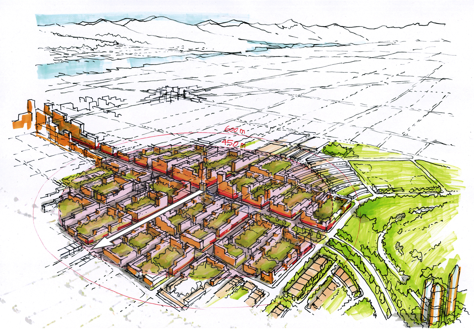
A preliminary design for public transit in Ottawa. Image: courtesy Perkins+Will
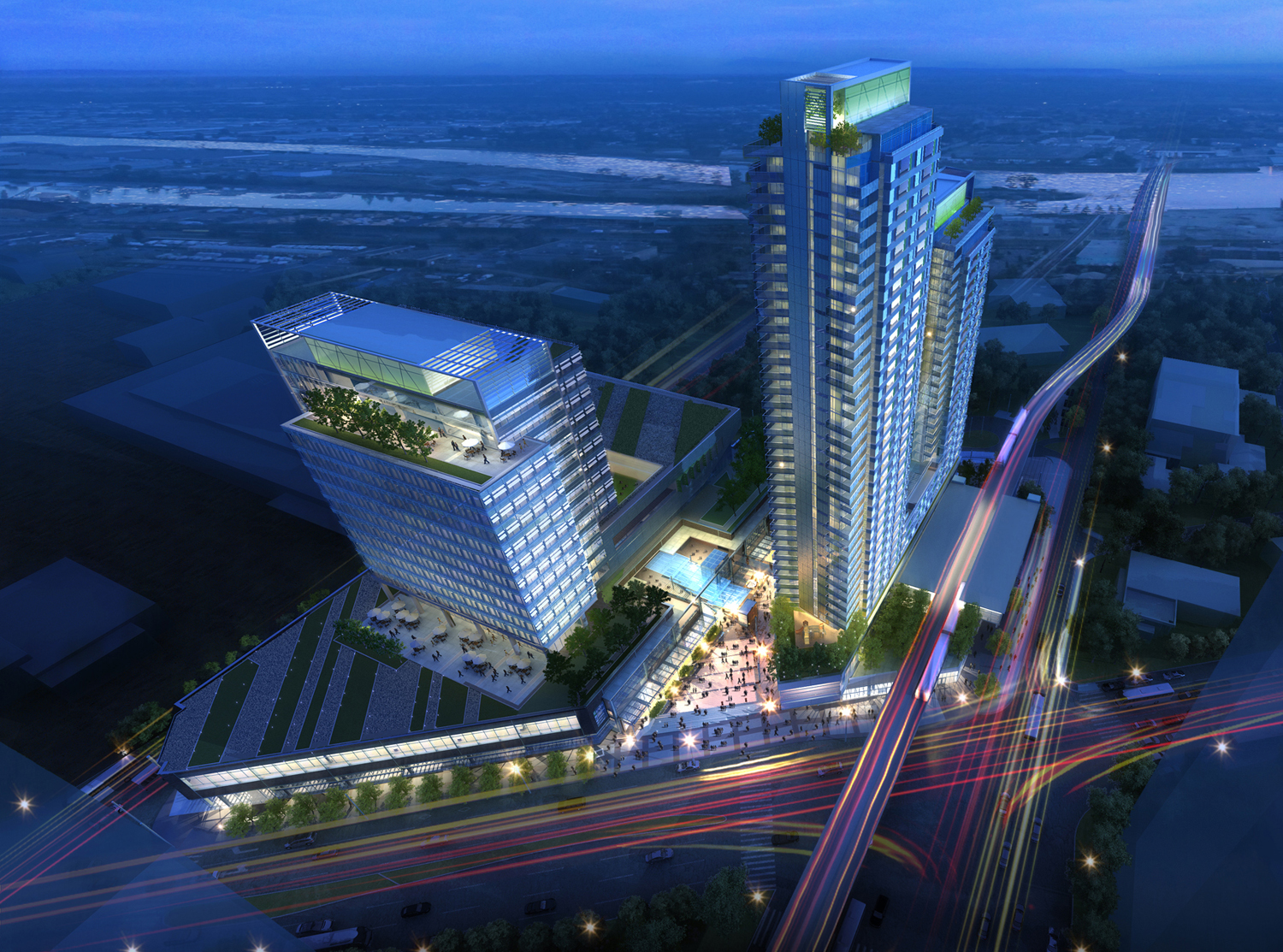
The Marine Gateway development in Vancouver. Image: courtesy Perkins+Will
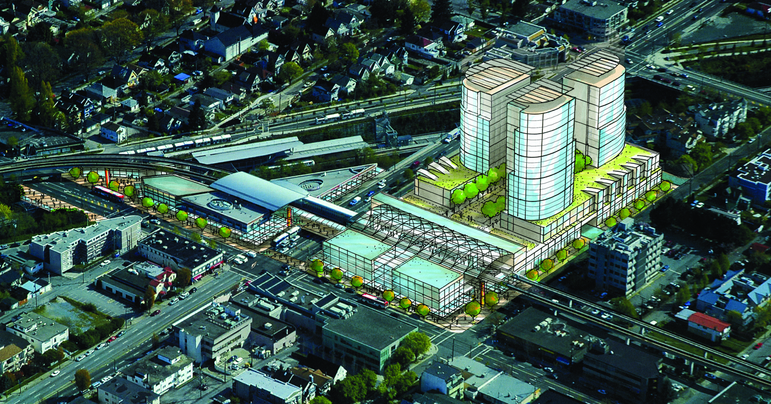
Broadway and Commercial station in East Vancouver. Image: courtesy Perkins+Will
A study for Vancouver’s Cambie Corridor. Image: courtesy Perkins+Will
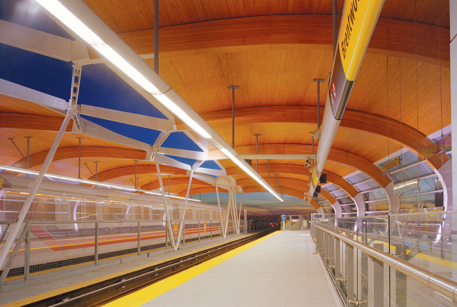
The Brentwood Skytrain station in Vancouver. Image: courtesy Perkins+Will
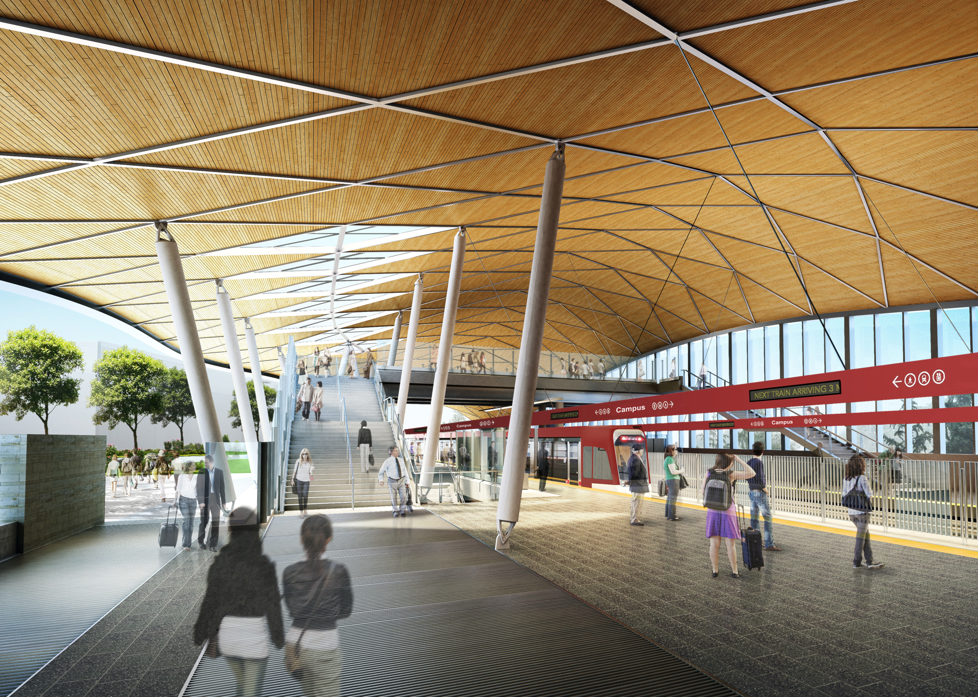
By Matthew Varcak
Jeff Doble is playing a key role in the future of one of the world’s most dynamic cities, Riyadh, Saudi Arabia. He is designing the new Riyadh Metro System and Bus Rapid Transit System — the largest transit system in the world to be designed and built at one time.
He talked about the priorities that cities set down in creating their new systems.
1) Iconic design. Doble says that the goal is to design structures which residents will recognize. Branding becomes important for cities establishing a transit system where there previously was none, according to Doble.
2) An easy ride. Clients also strive to create the best passenger experience. This means riders must feel safe and have clear signage and way finding.
3) A good fit. Another important factor is how the transit system is integrated into the community. “It must respond to and respect the community,” Doble said. Continue reading →
Comments Off on 5 Things On A City’s Shopping List For a New Transit System
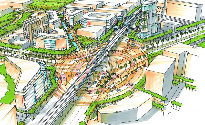
A study for the Olayya Batha Corridor in Riyadh, Saudi Arabia. Image: courtesy of Perkins+Will.
By Matthew Varcak
A public transit system does more than just get people from point A to point B.
“Cities can be defined by transit systems,” said Jeff Doble, director of transportation design for the Vancouver office of Perkins+Will. “A station’s design affects the whole community. It affects future development.”
Doble is playing a key role in the future of one of the world’s most dynamic cities, Riyadh, Saudi Arabia. He and his team recently completed the preliminary design of the new Riyadh Metro System and Bus Rapid Transit System — the largest transit system in the world to be designed and built at one time.
“The goal is to get an oil rich population out of cars and into public transit,” Doble said. In order to convince them to do this, mass transit must be more comfortable, convenient, and a high quality experience for passengers.
But designing such systems is an everyday event for his company. A global architecture and design firm for everything from the aviation to the transit industry, Perkins+Will currently has projects under way all over the world.
Among other projects, Doble’s work has him developing stations for the Evergreen Line in Vancouver, British Columbia, and for the elevated rail line on Oahu, Hawaii, which we spotlighted in an earlier article. Continue reading →
Comments Off on Inside The Future Of Public Transit Design
During the past year, American gasoline prices dropped and more people went back to work. But they also did something else: jump on public transportation.
More people rode public transit in the United States last year than at any time since 1956, according to a new report from the American Public Transportation Association.
Some 10.65 billion passenger trips were taken on transit systems during the year, which is up 1.1 percent from 2012. That surpassed the most recent peak of 10.59 billion in 2008. It’s the eighth year in a row that Americans took more than 10 billion transit trips.
Moreover, public transit growth over the past two decades has risen 37.5 percent, outpacing population growth, which was up 20 percent from 1995 to 2013.
There’s a ton of great data in the report, and we’ll be breaking it out for you over the next few days. Meanwhile, did you use public transit in 2013? Did you use it for the first time? Let us know your transit stories.
Comments Off on Riding The Bus, The Subway, The Streetcar: U.S. Transit Use At Its Highest Since 1956
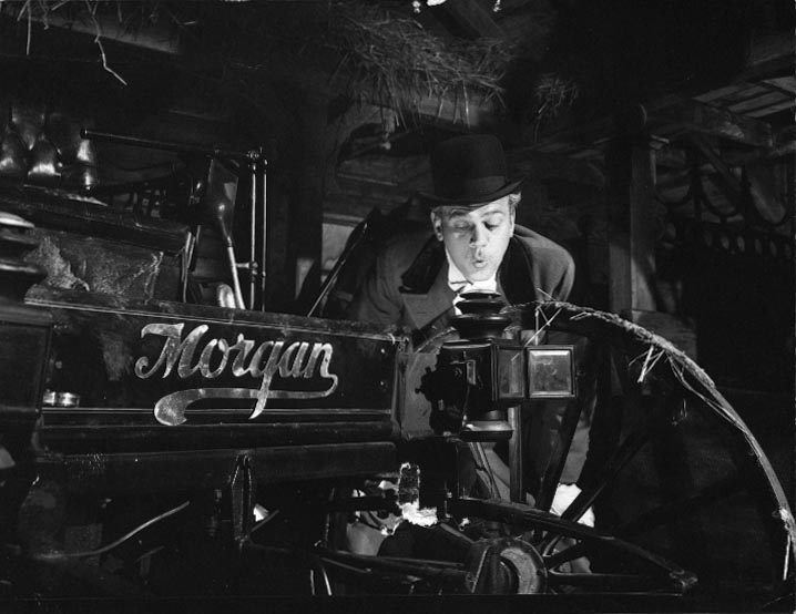
Eugene Morgan (Joseph Cotton) demonstrating one of his automobile prototypes, from Orson Welles’s film The Magnificent Ambersons (RKO Pictures, 1942)
Here’s the first installment of Curbing Cars @ The Movies, in which our Research Director Rick Meier explores four cinematic visions of the future of cars and driving. In Part 1, we look back to turn of the 20th century, and the invention of the automobile. We see how the horseless carriage transformed the idyllic, pre-industrial city of Indianapolis, in Orson Welles’ The Magnificent Ambersons (1942).
By Rick Meier
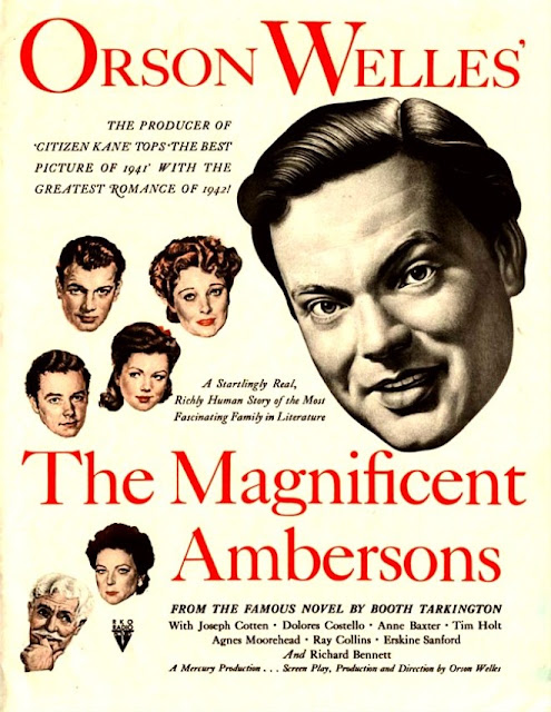
In 1942, immediately following his spectacular debut in Citizen Kane, Orson Welles delivered his second feature release to RKO Pictures: an elegant adaptation of Booth Tarkington’s Pulitzer Prize-winning novelThe Magnificent Ambersons (originally published in 1918).
It is the story of the once grand and prosperous Ambersons: rich and influential property owners in a small but thriving “Midland town” (based on Tarkington’s native Indianapolis, during the opening years of the 20th century).
Welles opens his film with a series of vignettes portraying the way it used to be in sleepy, pre-industrial Indianapolis. In the first vignette we learn that, “back in those days” the only public convenience was the streetcar, and one on which the rules of chivalry were not yet dead.
The film follows the great Amberson family and its ever-watchful neighbors as succeeding generations of Amberson heirs fail to maintain the great wealth and position won by their patriarch, Major Amberson. Faithful to Tarkington’s novel, Welles’s adaptation is set against the backdrop of America’s second industrial revolution (also known as the technological revolution). Behind each personal tragedy of the Ambersons we perceive the changing world of their bustling community as their quaint Midland town progressively spreads and darkens into a modern city.
Ultimately, the greatest threat to the eminence of the Ambersons comes from the newly invented automobile. The family’s prospects begin to dwindle as the Amberson-owned houses on National Avenue (a district based on the real-life neighborhood of Woodruff Place, in Indianapolis) start to depreciate in favour of newer upscale suburban neighborhoods, now more accessible by car, and located further and further away from the increasingly smoky and bustling industry of the downtown core.
In a crucial scene, George—the current Amberson heir—disparagingly characterizes the automobile as a useless nuisance, giving rise to an insightful speech from the automobile manufacturer and family friend, Eugene Morgan (played by Joseph Cotton), about the ways automobiles could potentially impact human life.
The subtext that drives the Magnificent Ambersons is the story of how the rise of driving gave birth to the suburb. Here at Curbing Cars we look at the still-unfolding story of how the now increasing burdens of car ownership is coinciding with an historic period of re-urbanization.
Tune in next week for the second installment in this four-part series on cars in cinema, featuring Minority Report (2002)
Comments Off on Curbing Cars @ The Movies: The Magnificent Ambersons And The Invention Of The Automobile
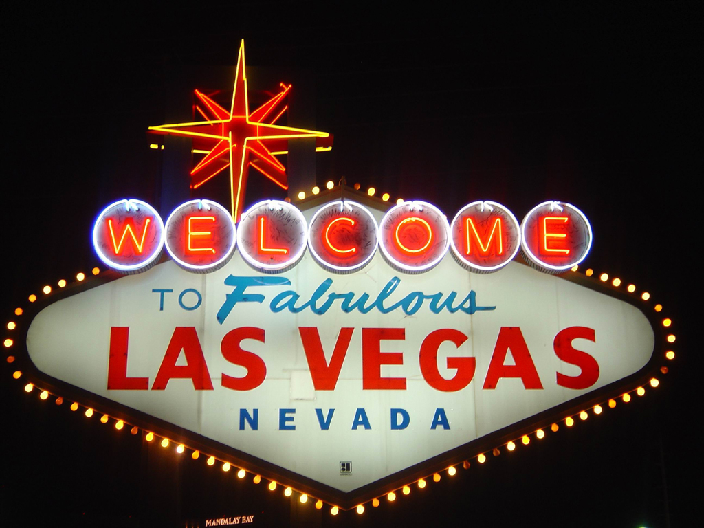
If you’ve been to Las Vegas, it’s likely that you’re not thinking about transportation. You’re looking at neon signs, hearing the jangle of slot machines, or watching an elaborate show.
Yet, The Atlantic Citiesreports that Vegas might wind up being a major laboratory for the future of car ownership. Specifically, the idea comes from Project 100, which has been launched by Tony Hsieh, the chief executive of Zappos, the online shoe retailer that is based downtown.
Project 100’s name derives from the quantity of vehicles it plans to offer, according to Cities: “100 Tesla S sedans equipped with professional drivers (a la Uber), 100 short-range electric vehicles you drive yourself (e.g. Zipcar or Car2go), 100 bicycles for sharing, and shuttles with 100 stops across the area. At launch, however, the service will be much smaller. No drivers, no shuttles — only a trolley car on an infinite loop and a handful of Teslas rentable by the minute or hour.”
While apparently a first for America, something like it has been tried in Germany. Continue reading →
Comments Off on Vegas, Baby: Could Sin City Become A Transit Model?
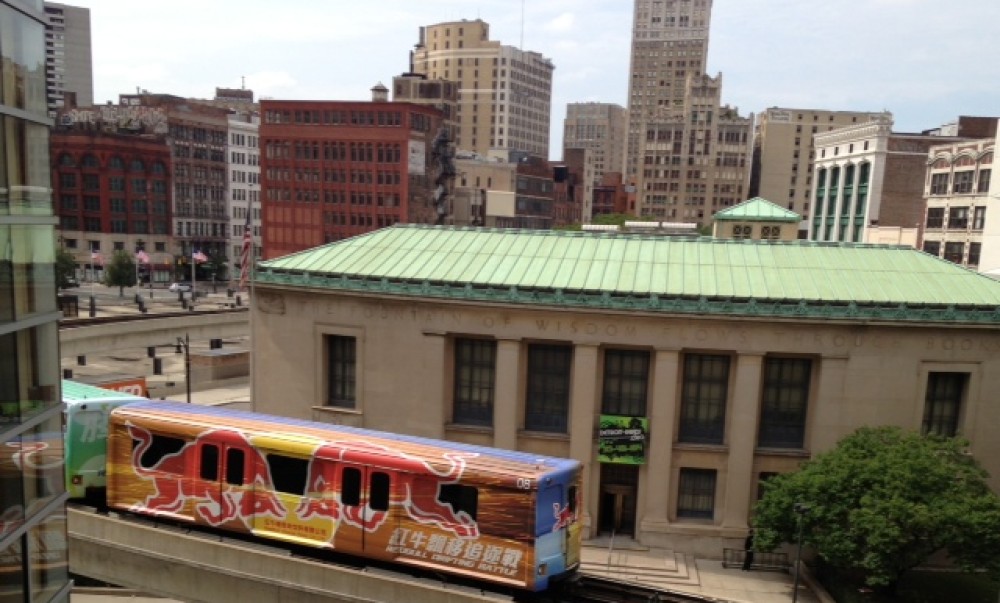
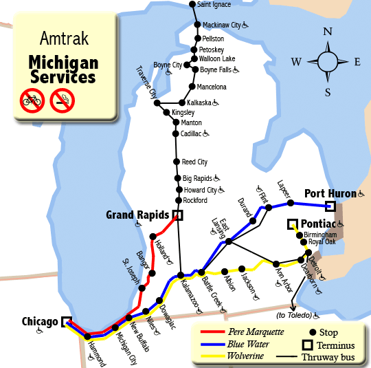
Michigan is seemingly divided into two unequal sections, and that doesn’t just mean the Upper and Lower Peninsulas. When it comes to passenger rail service, the bottom half of the Lower Peninsula is serviced by three major corridors, while the rest of the state has none.
But plans are in the works for passenger rail service to reach one northern tourist destination – Traverse City.
While navigating the southern part of the state is fairly simple with the available trains, buses and taxis, the northern half is virtually inaccessible without a personal vehicle or plane. There are few alternatives besides a once-daily bus which departs from Kalamazoo heading north and includes several stops (namely Traverse City) before ending in Sault Ste. Marie, located on the Canadian border.
The lack of passenger rail to the northern half of Michigan will soon change, as the state looks to expand its light rail service.
“We could possibly have a passenger rail to Traverse City under way in the next five to six years,” said Nick Schirripa, spokesman for the Michigan Department of Transportation. “It may happen sooner.” Continue reading →
Comments Off on Can Trains Go Farther In Michigan?